Sheet A-13-CEUS-SSC Project GIS Data Summary
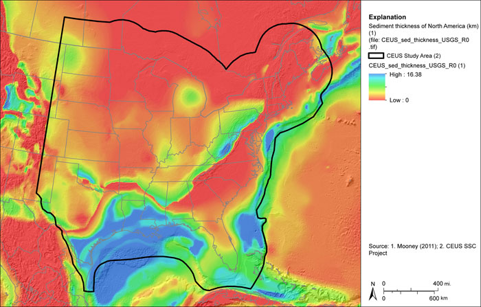
Sediment Thickness for North America and Neighboring Regions
Download: ![]() Download GIS Data |
Download GIS Data | ![]() Download PDF Figures for Technical Use
Download PDF Figures for Technical Use
Data Files: CEUS_sed_thickness_USGS_R0.tif
Data Description: Surface depicting sediment thickness provided by W. Mooney. These are the digital data presented during Workshop #1 on July 22, 2008. These data were subsequently displayed in the article referenced below.
Source (Internet URL, CD/DVD-ROM): Figure of the sediment thickness data provided during a presentation by W. Mooney during Workshop #1, July 22, 2008. Digital data provided by W. Mooney on September 29, 2011.
Author/Publisher/Year: Mooney, W.D., 2011, personal communication. Data was presented as a figure in:
Mooney, W.D. and Kaban, M.K., 2010, The North American upper mantle: Density, composition, and evolution: Journal of Geophysical Research, v. 115.
Data Summary: Values in the GeoTIFF represent sediment thickness in km. Data are spaced at 30 arc-seconds (0.08333 degrees). Data are presented in geographic coordinates on the North American Datum of 1983.
Disclaimer or Constraints on Use: The author’s citation should be referenced in all subsequent uses of this data.
Figure A-14
Sediment thickness for North America and neighboring regions