Sheet A-14-CEUS-SSC Project GIS Data Summary
USGS Physiographic Divisions of the Conterminous United States
Download: ![]() Download GIS Data |
Download GIS Data | ![]() Download PDF Figures for Technical Use
Download PDF Figures for Technical Use
Data Files: CEUS_physio_USGS_R0.shp
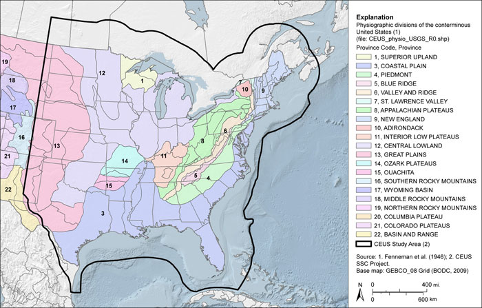
Data Description: This data set is a polygon representation of Fenneman and Johnson’s “Physiographic Divisions of the United States.” This map divides the U.S. into eight major divisions, 25 provinces, and 86 sections representing distinctive areas having common topography, rock types and structure, and geologic and geomorphic history.
Source (Internet URL, CD/DVD-ROM): USGS (2002): http://water.usgs.gov/GIS/dsdl/physio.gz
Author/Publisher/Year: Fenneman, N.M., and Johnson, D.W., 1946, Physiographic Divisions of the United States, U.S. Geological Survey (USGS), Washington, D.C., http://water.usgs.gov/GIS/dsdl/physio.gz
Data Summary: The source map was compiled as a Download GIS Data set by the USGS and made available online at the website listed above. Features were digitized from a mylar base and presented in a polyconic projection. The scale of the data is 1:7,000,000. The data layer is an ESRI polygon shapefile. Data are presented in geographic coordinates on the North American Datum of 1983.
Disclaimer or Constraints on Use: These data are most appropriate for small-scale (regional) analysis rather than for assessment for specific locations.
Figure A-15
Physiographic divisions of the conterminous United States after Fenneman and Johnson (1946)