Sheet A-2-CEUS-SSC Project GIS Data Summary
CEUS-SSC Earthquake Catalog Compilation
Download: ![]() Download GIS Data |
Download GIS Data | ![]() Download PDF Figures for Technical Use
Download PDF Figures for Technical Use
Data Files: CEUS_EQ_Catalog_R0.shp
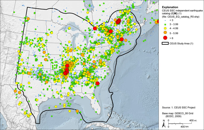
Data Description: This map layer contains the earthquake catalog for the CEUS-SSC Project. Source catalogs were merged to derive a preliminary catalog with duplicates and alternative estimates of location, magnitude, seismic moment, macroseismic intensity, and felt area. Relationships between the size measures presented in the source data were used to develop a common moment magnitude (M). The M-based catalog was then processed to identify and remove aftershocks using the methodology developed in EPRI-SOG (1988), thereby producing a catalog of independent earthquake events.
Source (Internet URL, CD/DVD-ROM): Records were obtained from several sources: USGS, GSC, NCEER, EPRI-SOG, ANSS, CERI, SUSN, SLU, Lamont-Doherty, Weston Observatory, NEDB, ISC, Jeff Munsey, Ann Metzger, Margaret Hopper, Sykes et al. (2008), and the Ohio Seismic Network.
Author/Publisher/Year: Several sources were compiled for this study. See accompanying metadata for complete reference list.
Data Summary: ESRI point shapefile with moment magnitude (M)
Disclaimer or Constraints on Use: No constraints have been identified.
Figure A-2
CEUS-SSC independent earthquake catalog