Sheet A-27-CEUS-SSC Project GIS Data Summary
Mesozoic Rift Basin after Dennis et al. (2004)
Download: ![]() Download GIS Data |
Download GIS Data | ![]() Download PDF Figures for Technical Use
Download PDF Figures for Technical Use
Data Files: CEUS_basins_Dennis_etal_2004_R0.shp
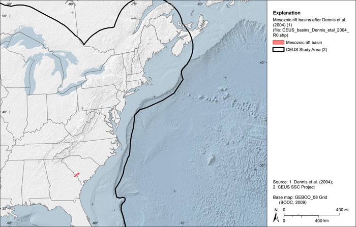
Data Description: This data layer presents the location of the Dunbarton rift basin in South Carolina as presented by Dennis et al. (2004). The western portion of the basin is truncated as presented in the source figure.
Source (Internet URL, CD/DVD-ROM): Figure from publication cited below.
Author/Publisher/Year: Dennis, A.J., Shervais, J.W., Mauldin, J., Maher Jr., H.D., and Wright, J.E., 2004, Petrology and geochemistry of Neoproterozoic volcanic arc terranes beneath the Atlantic Coastal Plain, Savannah River Site, South Carolina: GSA Bulletin, v. 116, pp. 572-593.
Data Summary: Source figure was originally published at a scale of 1:450,000. Feature was digitized at a scale of 1:450,000 or better and saved as an ESRI polygon shapefile. Data are presented in geographic coordinates on the North American Datum of 1983.
Disclaimer or Constraints on Use: No constraints have been identified.
Figure A-68
CEUS Mesozoic rift basins after Dennis et al. (2004)