Sheet A-30-CEUS-SSC Project GIS Data Summary
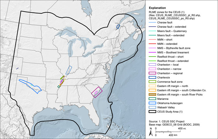
CEUS-SSC Repeated Large-Magnitude Earthquake (RLME) Zones
Download: ![]() Download GIS Data |
Download GIS Data | ![]() Download PDF Figures for Technical Use
Download PDF Figures for Technical Use
Data Files:
Data Description: These data layers present the zones of repeated large-magnitude earthquakes (RLME) developed from the CEUS-SSC Project. Zones are separated into separate lines or polygon data layers depending on the geometry of the RLME zone.
Source (Internet URL, CD/DVD-ROM): CEUS-SSC Project.
Author/Publisher/Year: CEUS-SSC Project.
Data Summary: Data layers are in the ESRI line and polygon shapefile formats. Data are presented in geographic coordinates on the North American Datum of 1983.
Disclaimer or Constraints on Use: No constraints have been identified.
Figure A-71
RLME zones for the CEUS