Sheet A-31-CEUS-SSC Project GIS Data Summary
CEUS-SSC Mesozoic and Non-Mesozoic Zones and Seismotectonic Zones
Download: ![]() Download GIS Data |
Download GIS Data | ![]() Download PDF Figures for Technical Use
Download PDF Figures for Technical Use
Data Files: CEUS_STZones_CEUSSSC_pl_R0.shp
Data Description: This data layer presents the Mesozoic and Non-Mesozoic zones and seismotectonic zones developed from the CEUS-SSC Project. Zones are presented as polygon data layers attributed with the name of the zone.
Source (Internet URL, CD/DVD-ROM): CEUS-SSC Project.
Author/Publisher/Year: CEUS-SSC Project.
Data Summary: Data layer is in ESRI polygon shapefile format. Data are presented in geographic coordinates on the North American Datum of 1983.
Disclaimer or Constraints on Use: No constraints have been identified.
Figure A-72
Mesozoic and non-Mesozoic zones for the CEUS, wide interpretation
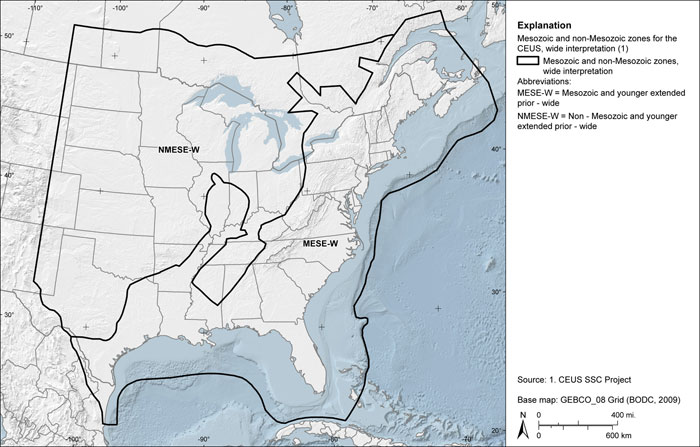
Figure A-73
Mesozoic and non-Mesozoic zones for the CEUS, narrow interpretation
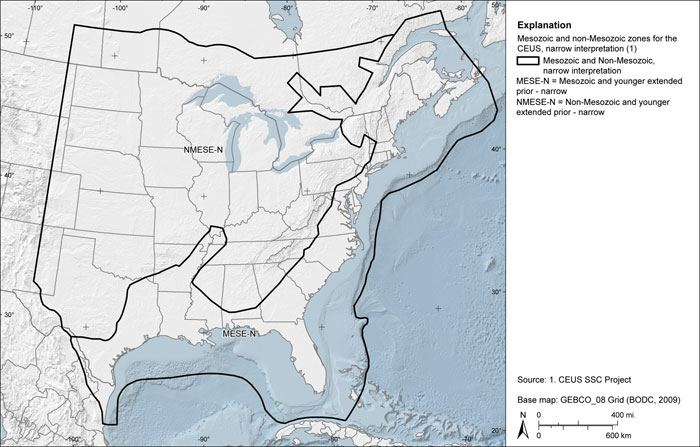
Figure A-74
CEUS seismotectonic zones model A
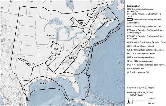
Figure A-75
CEUS seismotectonic zones model B
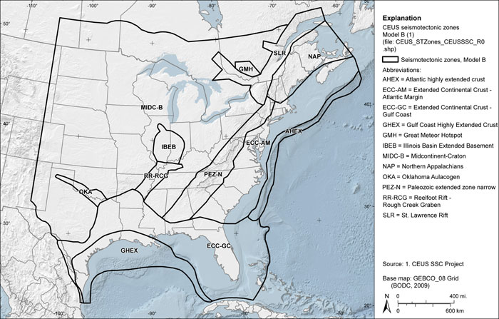
Figure A-76
CEUS seismotectonic zones model C
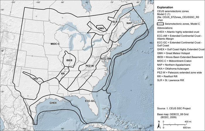
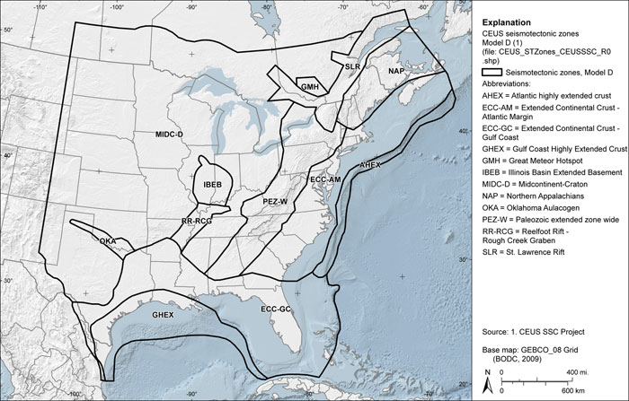
Figure A-77
CEUS seismotectonic zones model D