Sheet A-4-CEUS-SSC Project GIS Data Summary
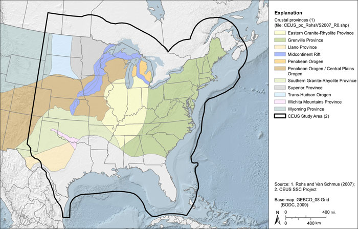
Crustal Provinces after Rohs and Van Schmus (2007)
Download:
Data Files: CEUS_pc_RohsVS2007_R0.shp
Data Description: Representation of crustal provinces, by age of crystallization, in the U.S.
Source (Internet URL, CD/DVD-ROM): Digitized after Rohs and Van Schmus (2007), Fig. 1, at a scale of 1:33,000,000 or larger.
Author/Publisher/Year: Rohs, C.R., and Van Schmus, V.R., 2007, Isotopic connections between basement rocks exposed in the St. Francois Mountains and the Arbuckle Mountains, southern midcontinent North America: International Journal of Earth Sciences, v. 96, pp. 599611.
Data Summary: ESRI polygon shapefile representing crustal provinces. Each polygon is attributed according to the information presented in the source figure in Rohs and Van Schmus, 2007. Areas of empty polygon attributes represent areas of the conterminous U.S. that are not attributed in the source figure.
Disclaimer or Constraints on Use: No constraints have been identified.
Figure A-4
Crustal provinces after Rohs and Van Schmus (2007)