Sheet A-9-CEUS-SSC Project GIS Data Summary
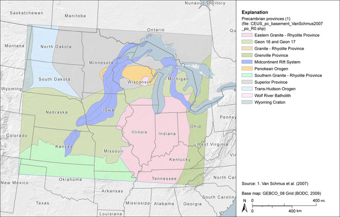
Precambrian Provinces after Van Schmus et al. (2007)
Download: ![]() Download GIS Data |
Download GIS Data | ![]() Download PDF Figures for Technical Use
Download PDF Figures for Technical Use
Data Files: CEUS_pc_basement_VanSchmus2007_R0.shp
Data Description: Data set represents Precambrian basement provinces as mapped by Van Schmus et al. (2007). Data extent covers a rectangular area from northwest North Dakota to northwest South Carolina.
Source (Internet URL, CD/DVD-ROM): Digitized from source figure in Van Schmus et al. (2007).
Author/Publisher/Year: Van Schmus, W.R. Schneider, D.A., Holm, D.K., Dodson, S., and Nelson, B.K., 2007, New insights in the southern margin of the Archean-Proterozoic boundary in the north-central United States based on U-Pb, Sm-Nd, and Ar-Ar geochronology: Precambrian Research v. 157, pp. 80-105.
Data Summary: ESRI polygon shapefile attributed according to Precambrian basement geology. Digitized at 1:13,500,000. Data are presented in geographic coordinates on the North American Datum of 1983.
Disclaimer or Constraints on Use: No constraints have been identified.
Figure A-9
Precambrian provinces after Van Schmus et al. (2007)